Ben Phillips
PhD Researcher | University of Liverpool | National Oceanography Centre
Useful tools
LISFLOOD-FP
I used LISFLOOD-FP, a raster based coastal and fluvial inundation model, extensively during my undergraduate dissertation. I also hope to use it during my PhD to calculate economic losses from various storm events. This will help me develop my real option analysis for calculating the optimum nourishment frequency. I have provided a Jupyter Notebook containing a manual for setting up the model, as well as the code needed to do so. Some of the code for calculating resultant velocity and flood hazard is still under development, and the input files for the boundary conditions will need to be generated by you in the context of your own study although examples are provided. It will be much easier if you work through the Jupyter Notebook and use the integrated Python script and functions, however a PDF version of the manual and code is provided.
Click here to download a PDF containing the manual and code
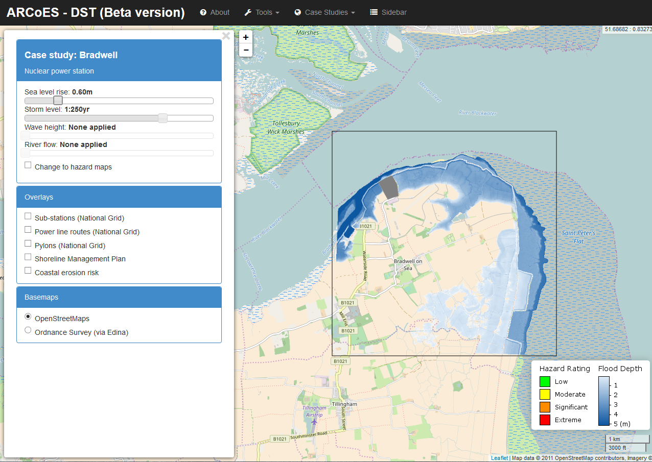
As part of the ARCoES project that funded my MPhil, LISFLOOD-FP was used to create a Decision Support System to aid coastal stakeholders to understand resilience of coastal energy supply in response to sea level rise. An example of this system applied to Bradwell is shown below, and can be accessed by clicking here.