Ben Phillips
PhD Researcher | University of Liverpool | National Oceanography Centre
My skills
Computational
![]()

![]()

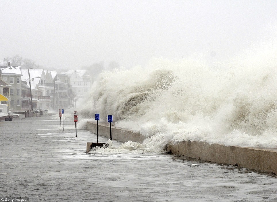
Modelling
- XBeach: A storm impact model for sandy beaches
- XBeach-G: A storm impact model for gravel beaches
- Coastal Vector Evolution Model (COVE): A two-line exploratory model for coastal evolution
- LISFLOOD-FP: A raster based coastal and fluvial inundation model
Research Experience
- Carried out consultancy with a Coastal Engineering Consultant
- International collaboration: Attended a summer school on lagoon hydrodynamics in Mexico
- I was employed as a research assistant to assess the feasibility of adding rivers to the ARCoES Decision Support System
- Planned logistics and carried out risk assessments for foreign field work in the USA
Demonstrating
- STUDY SKILLS AND GIS
- EXPERIMENTS IN PHYSICAL GEOGRAPHY
- COASTAL ENVIRONMENTS: SPATIAL AND TEMPORAL CHANGE
- CLIMATOLOGY
- LORCA FIELD TRIP (SOUTH EAST SPAIN)
Other Skills
- Full UK Driving Licence
- Outreach: Participated in NERC #intotheblue events with disseminating ARCoES project to general public
- Intermediate German
My Research
PhD: National Oceanography Centre and University of Liverpool
Future vulnerability of evolving gravel barrier coastlines- the impacts for flood risk management
- Supervisors: Dr Jenny Brown (NOC), Dr Martin Hurst (Glasgow University), Prof Gerd Masselink (Plymouth University), Dr Karyn Morrisey (Exeter University), Prof Andy Plater (University of Liverpool)
- Funding: NERC Understanding the Earth, Atmosphere and Ocean Doctoral Training Program (NE/L002469/1). CASE partner: Cardigan Bay Coastal Group
- Commenced October 2016
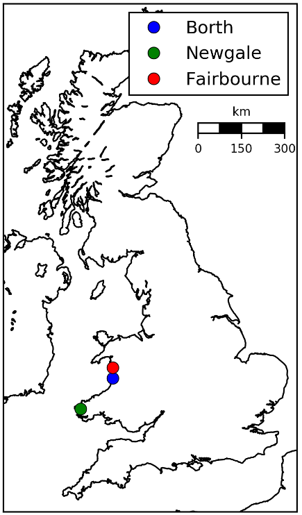
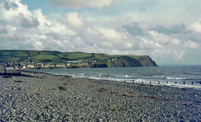
The three sites at which I will be developing (COVE) are shown above, and are of key interest for the CASE partner Cardigan Bay Coastal Group. COVE is a two-line model designed for mesoscale modelling of coastal evolution (seasonal to millenial timescales, over tens of kms). Coastal change in COVE is driven by longshore gradients in sediment flux (Qs) according to the CERC equation (see below). It allows the user to see how artifical nourishment at the coast interacts and evolves over time. The model is available from here
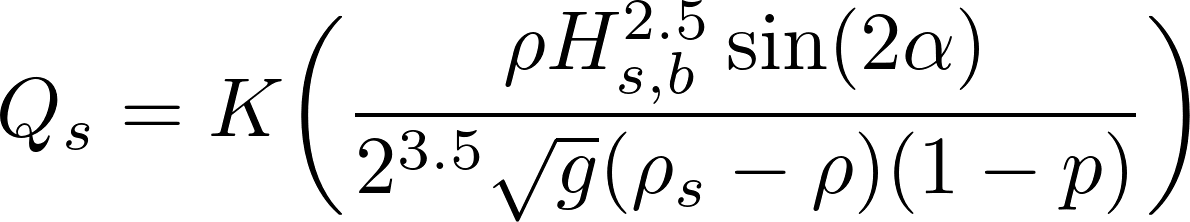
where:
- g = 9.81 m s2, gravitational acceleration
- K = 0.054, a dimensionless transport coefficient for gravel
- H2.5s,b = Breaking Wave Height (m)
- ρ = seawater density
- ρs = wet gravel density
- α = Breaking Wave Angle (radians)
- p = 0.45, porosity factor for gravel
MPhil: National Oceanography Centre and University of Liverpool
Role of beach morphology in wave overtopping hazard assessment
- Supervisors: Dr Jenny Brown (NOC) and Prof Andy Plater (University of Liverpool)
- Funding: EPSRC Adaptation and Resilience of Coastal Energy Supply (EP/I035390/1)
- October 2015- September 2016
- Published in a special issue of Journal of Marine Science and Engineering.
Understanding the role of beach morphology in controlling wave overtopping volume will further minimise uncertainties in flood risk assessments at coastal locations defended by engineered structures worldwide. XBeach is used to model wave overtopping volume for a 1:200 yr joint probability distribution of waves and water levels with actual, pre- and post-storm profiles and bathymetries. Each simulation is repeated with and without morphological evolution enabled during the modelled storm event. This assesses the role of morphology in controlling wave overtopping volumes for hazardous events that meet the typical design level of coastal defence structures. Results show disabling storm-driven morphology under-represents wave overtopping volumes by up to 36% under high Hs conditions, and to have a greater impact on the wave overtopping rate than the variability applied within the boundary conditions due to the range of wave-water level combinations that meet the 1:200 yr joint probability criterion. Accounting for morphology in flood modelling is therefore critical for accurately predicting wave overtopping volumes and the resulting flood hazard and to assess economic losses.
BSc (Hons) Geography, First Class Honours, University of Liverpool
September 2012 - June 2016
Work based dissertation with ARCoES project and Coastal Engineering UK Ltd.
- I developed a methodology to combine sea defence condition with flood risk to identify vulnerable areas throughout North Wales and North-West England.
- For this frontage, I modelled floods from sea defence breaches under UKCP09 sea level rise scenarios to provide a long term flood risk assessment for the frontage (Pensarn to Talacre in North Wales).
- This research gave me an insight into the field of coastal engineering, and the methodologies used to assess the condition of various types of hard and soft sea defence.